STRUCTURIGHT
  • Services
    • Structural Health Monitoring
    • Environmental Monitoring
    • Custom Solutions
  • About Us
  • Contact
  • Portal
  • Projects
    • GRS-202010-G-SEM
    • GRS-2021-02-A-SEM
    • RHD-2021-03-WH2-Internet
    • Frankfort Hotel

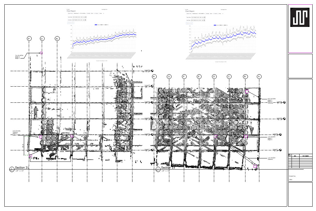
3D Drone Scanning and Structural Diagrams 


Site Survey

To best meet your needs, we begin by surveying your site and structure. Our three levels of surveying provide the baseline to begin monitoring. All surveys include review by a Structural Engineer to determine the types, number and placement of sensors units and to set thresholds for warning messages to the phone app. 

Survey Levels

Level One Deliverables: 
  • Topical Drone Scan of Exterior
  • Wireframe Diagram of Structure
  • BIM Model
  • Maps and Diagrams for Apps​
 
Level Two Deliverables: All of the above, plus...
  • RTK GPS Drone Scan (for site landscape contours)
  • Extensive Photo Survey of Interior
 
Level Three Deliverables: All of the above, plus...
  • LiDAR Scan of Interior
  • Detailed Materials Diagrams
  • Detailed Connections Diagrams 

Examples of Deliverables

Wireframe Diagram of Structure

Picture

BIM Model 

Picture

Topical Drone Scan of Exterior

Maps and Diagrams for Phone Apps


Inquire
Picture
816 East Broadway,
Louisville KY. 40204

Phone: (859) 621-0492
Email: [email protected]
ALL RIGHTS RESERVED. 2022 STRUCTURIGHT©
  • Services
    • Structural Health Monitoring
    • Environmental Monitoring
    • Custom Solutions
  • About Us
  • Contact
  • Portal
  • Projects
    • GRS-202010-G-SEM
    • GRS-2021-02-A-SEM
    • RHD-2021-03-WH2-Internet
    • Frankfort Hotel